
Category Archives: Parques Nacionales – National Parks COSTA RICA
RESERVATIONS TO CLIMB CHIRRIPÓ
AS OF MAY 2016, reservations to Chirripó National Park may be made online.
http://www.elpais.cr/2016/02/11/a-partir-de-mayo-se-podra-reservar-online-para-subir-el-chirripo/
REFUGIO CERRO DANTAS
 San Rafael de Heredia, PARQUE NACIONAL BRAULIO CARRILLO, Costa Rica
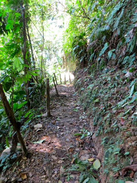
• La caminata es de entre 4 y 6 horas ida y vuelta, dependiendo de dónde empezamos, lo cual depende de dónde se deja el carro (vehículo SUV).
 • Los senderos tienen lodo y son resbalosos.
• Yo no cobro por guiar, pero el Refugio cobra ₡2.500 por entrar.
 • Altura: 1.900 a 2.100 metros en el lado Atlántico de la División Continental. Algunos días son fríos y llueve. Espere temperaturas entre 15ºC y 20ºC.
• Si van, necesito que me avisen por lo menos 5 días antes. Esta caminata puede hacerse un fin de semana, o durante la semana si están libres.
• Es mejor andar con botas de hiking. Los zapatos tenis está bien, pero se manchan y además, es resbaloso.
• Todos debemos llevar mochila con:
√ Capa
√ Botella de agua
√ Sombrero
√ Algo e comida
√ Camisa de manga larga y una jacket liviana.
• Yo no nadaría allá arriba, pero a algunas personas no les molesta nadar en agua fría.
✿✿✿✿✿✿✿✿✿✿✿
 • The hike into Refugio Cerro Dantas is a 4 to 6 hour day round trip depending from where you start, which depends on where you can drive to (high clearance vehicle).
• Trails are very muddy and slippery.
 • I don’t charge for guiding, but the Refugio charges ₡2500 entrada.
• The altitude is 1900 to 2100 meters on the Atlantic side of the Continental Divide so some days are cool and rainy. Expect 15ºC to 20ºC (59ºF – 68ºF).
• I need at least 5 days notice. This hike can be done Saturday or Sunday, or during a weekday if you have the time.
• It’s best to wear hiking boots. Sneakers are ok but the mud will stain them and it’s slippery.
• Everyone should have a dayhike pack with:
√ Raincoat
√ Water bottle
√ Hat
√ Food
√ Long sleeve shirt, sweatshirt, and light jacket.
• I wouldn’t swim there, but some people don’t mind swimming in cold water.
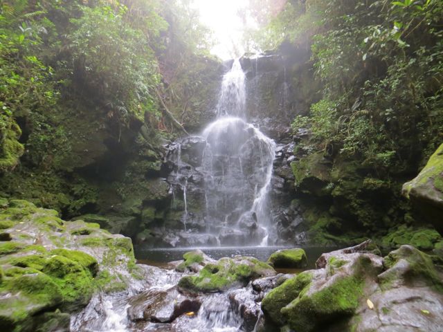
CATARATA Quebrada Grande WATERFALL
 Richard Tandlich tel. 2267-6325
Volcán TURRIALBA Volcano
Here’s a link to the OVSICORI site, where a camera was installed 600 yards east of the active crater to view the activity. It refreshes frame every 10 seconds, making the view almost in real time.
Este es el vínculo a OVSICORI, para ver la actividad del volcán por medio de una cámara que instalaron a 600 metros este del cráter activo. La imagen se refresca cada 10 segundos, lo se asemeja a verlo en tiempo real.
http://www.ovsicori.una.ac.cr/index.php?option=com_content&view=article&id=43&Itemid=74
This volcano is very active, and entrance to the park has been restricted lately.
ERUPTION MARCH 13, 2015:
https://www.facebook.com/video.php?v=713567785409200&set=vb.100998329999485&type=2&theater
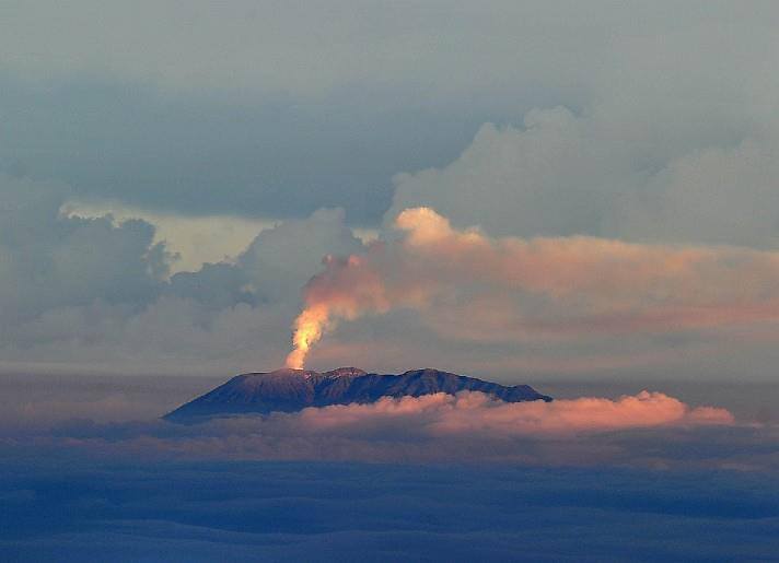
Turrialba volcano seen from the top of Chirripó mountain on 12 March, 2015

Arriving – llegando

Este volcán está muy activo y la entrada al parque ha estado cerrada últimamente.
HIKE AND LODGE WITH US! – ¡HOSPÉDESE Y CAMINE CON NOSOTROS!
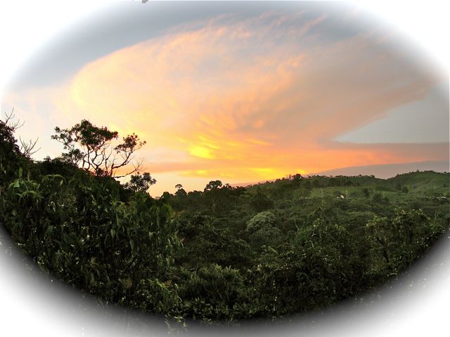
Volcán BARVA Volcano National Park
 One of the most scenic hikes. Caminata pintoresca.
Barva Volcano is dormant (or so we hope!) and occupies the largest volcanic land area in Central America: its massive expands for a square mile, with an altitude of 9500 feet. Even though it is only 4 miles away from my house as the toucan flies, driving there takes about an hour through hills and curves, but it’s a beautiful hiking destination.
El Barva es un volcán dormido (o por lo menos, ¡eso esperamos!), el cual ocupa la extensión volcánica más grande de Centroamérica: su masivo se extiende 1500 kilómetros cuadrados, con una altitud de 2900 metros sobre el nivel del mar. A pesar de estar a escasos 6 kilómetros aéreos de mi casa, por carretera toma una hora llegar allí. Es uno de mis destinos favoritos para caminar. 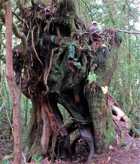
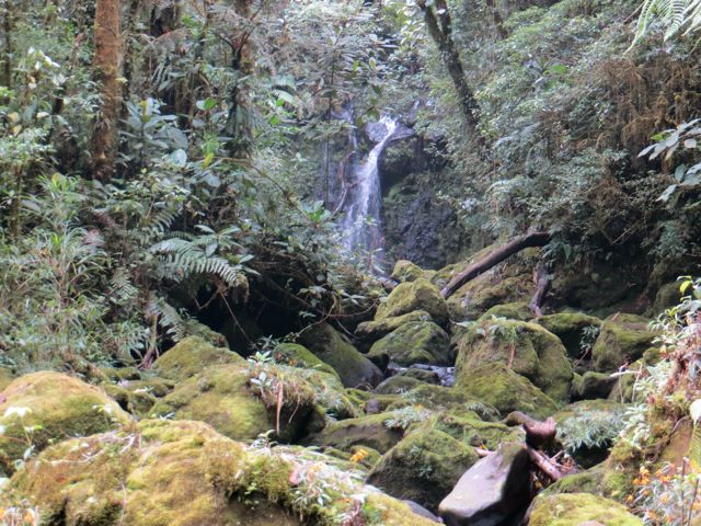
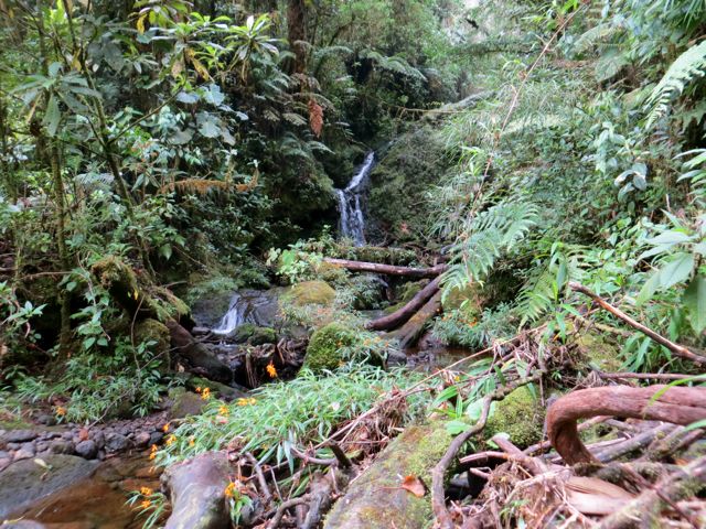
The old crater is now a lagoon 26 feet deep and 230 feet in diameter, with temperatures between 50º and 64ºF., and cloud forests all around.
El viejo cráter es ahora una laguna de 8 metros de profundidad y 70 metros de diámetro, con tempera-
turas entre 10º y 18ºC y rodeado de bosque nuboso.
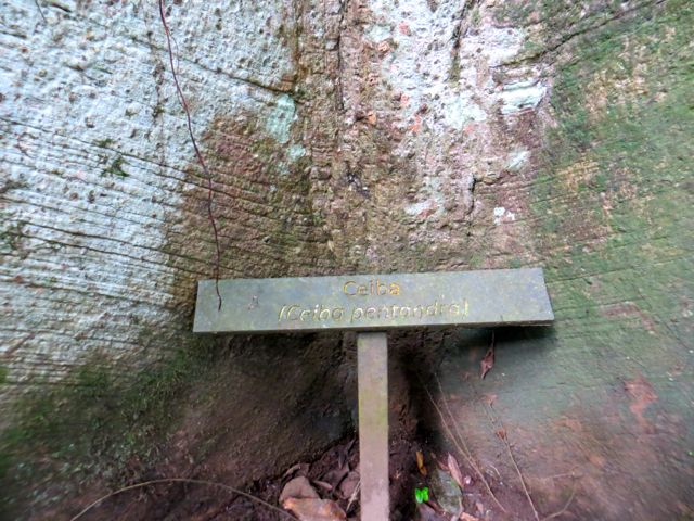
My daughters used to call it, “the enchanted forest”. Barva is known for its fantastic vegetation and hiking trails.
Mis hijas usaban llamarlo “el bosque encantado”. El Barva es famoso por su vegetación fantástica y sus senderos para caminar. 

Difficult hike – Caminata difícil
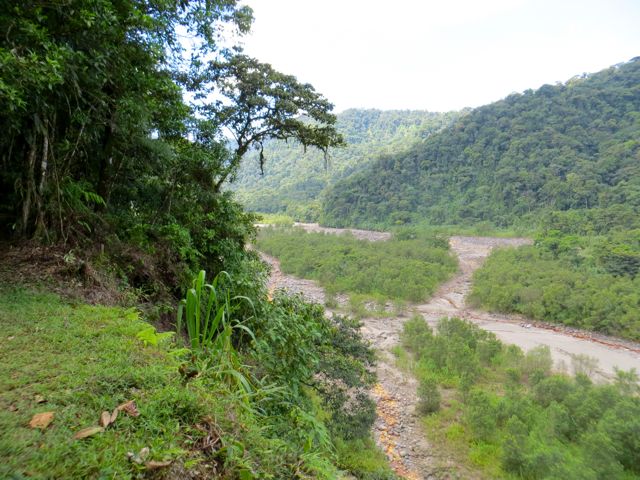
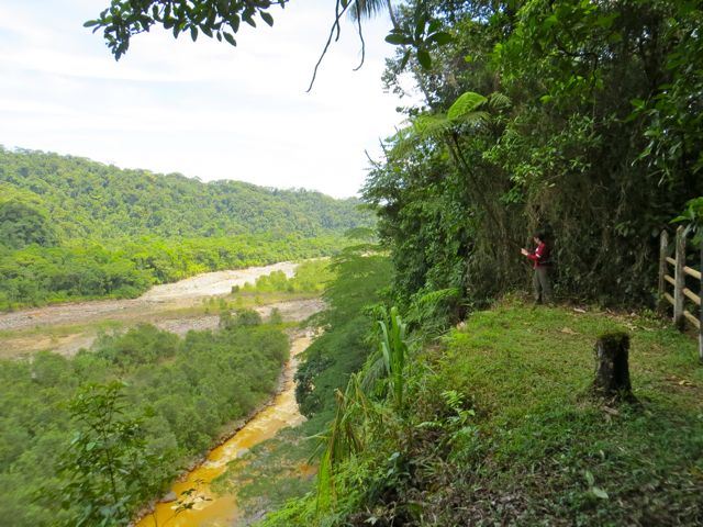
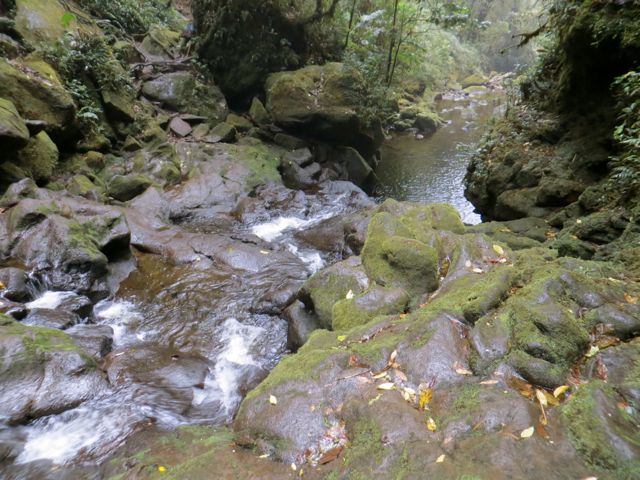
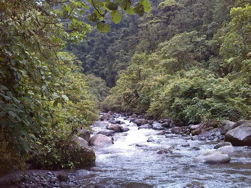
 Last Saturday, Rich and friends from CONCEVERDE Conservancy decided to explore an area of the Patria River, within Braulio Carrillo National Park “next door.” They had already done part of it last year, but this time they decided to take advantage of the drought we’re having, and explore the area. It turned out to be an extremely difficult six hour hike, with a 600 meter vertical on the way back: not for everyone, but the Patria is a beautiful river!
El sábado pasado, Rich y amigos de CONCEVERDE decidieron explorar el área del Río Patria, dentro del Parque Nacional Braulio Carrillo. Ya habían hecho parte de esta caminata el año pasado, pero decidieron aprovechar la sequía de este año, para aventurarse más adentro. Resultó ser una caminata sumamente difícil, con una pendiente de 600 metros que les tomó 3 horas a la vuelta. ¡No es para todos, pero la zona del Patria es bella!
—Silvia Piza-Tandlich
Real-time view of Poás Volcano – Vista en tiempo real del VOLCÁN POÁS
OVSICORI (Volcanologic and Seismologic Observatory of Costa Rica), has installed a camera near the Poás Volcano crater. We can check weather and activity conditions before making the trip to the top.
http://www.ovsicori.una.ac.cr/index.php?option=com_content&view=article&id=108&Itemid=103
El OVSICORI (Observatorio Vulcanológico y Sismológico de Costa Rica) ha instalado una cámara en el cráter del Volcán Poás. Ahora podemos ver las condiciones climáticas y la actividad del volcán, antes de hacer el viaje a la cima.
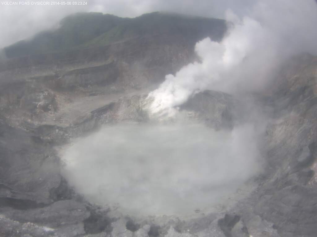
http://www.ovsicori.una.ac.cr/
Parque Nacional BARRA HONDA National Park


INVESTIGATING THE ANCIENT ROAD – Investigando por el antiguo camino
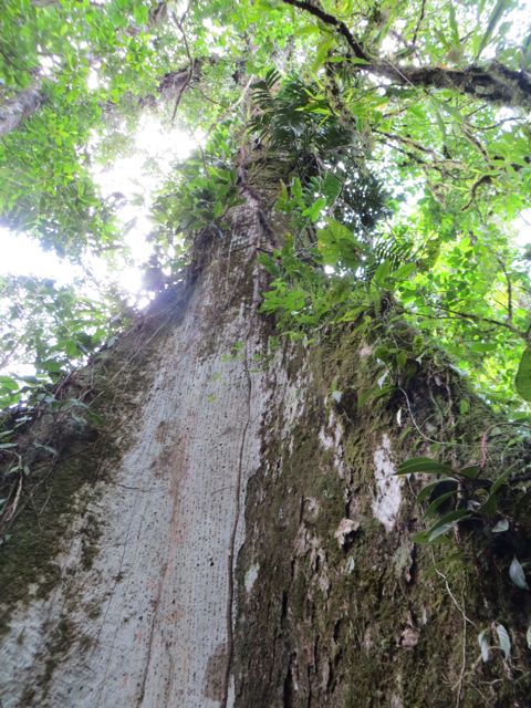
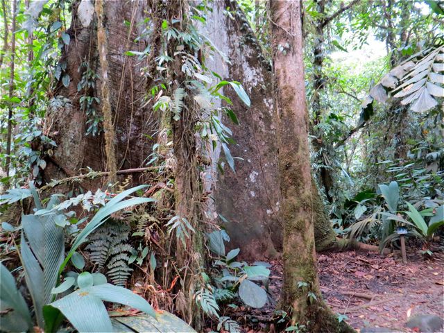
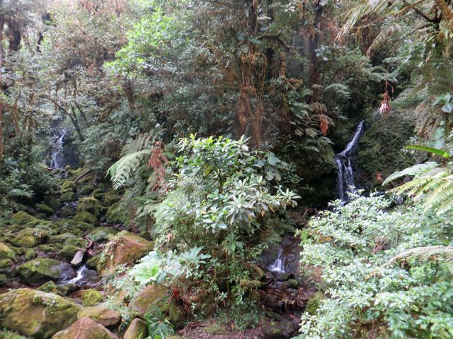
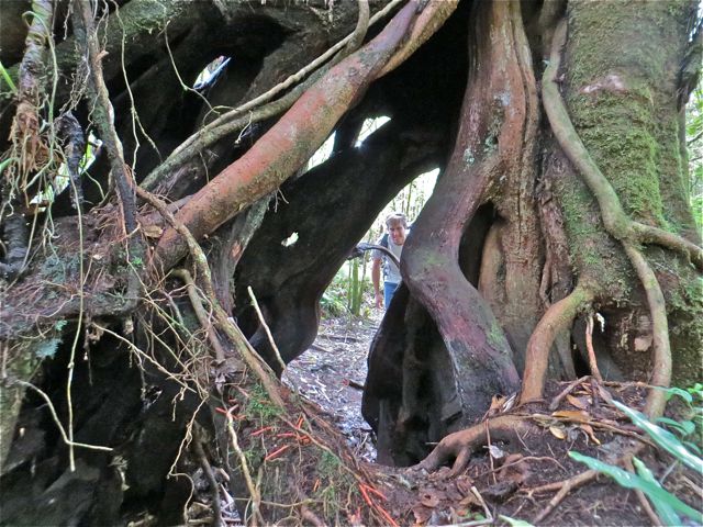
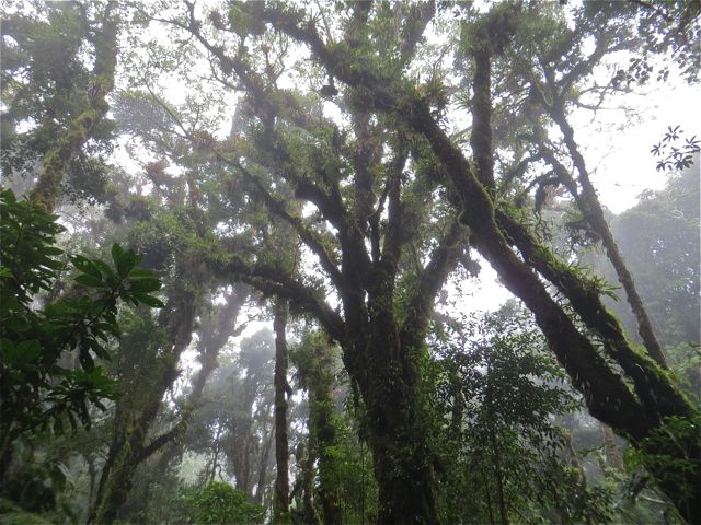
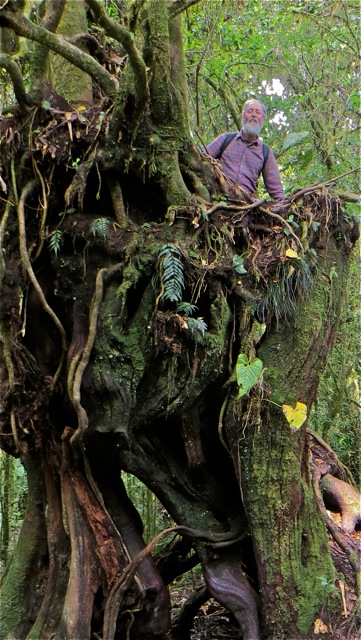
Braulio Carrillo National Park is one of the most impressive places in Costa Rica due to its dense vegetation, altitude changes, and climate conditions. It covers almost 46000 hectares, pretty much from the Continental Divide (Central Volcanic Range) sloping down the Caribbean side.
El Parque Nacional Braulio Carrillo es uno de los más imponentes en Costa Rica debido a su densa vegetación, cambios de altura y condiciones climáticas. Cubre casi 46000 hectáreas desde la División Continental en la Cordillera Volcánica Central, bajando hacia el lado Caribe.

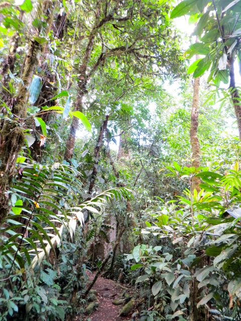
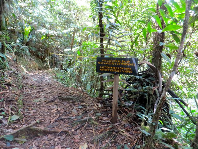
The Range has a series of passes in between peaks, which allow entry of trade winds from the Caribbean into the Central Valley. These passes also connect land and air traffic between the northern, Atlantic, and Central zones. We started our hike at Paso La Palma, which is relatively close to our respective towns in Heredia province. However, the La Palma Pass is part of San Jerónimo de Moravia at 1600m elevation.
La Cordillera tiene una serie de pasos entre los macizos, lo cual permite el paso de los vientos alisios del Caribe hacia el Valle Central. Estos pasos conectan tráfico por tierra y aire entre la Zona Norte, la del Caribe y la del Valle Central. Iniciamos la caminata por el Paso La Palma, que está relativamente cerca de nuestros respectivos pueblos de la provincia de Heredia. Sin embargo, el Paso La Palma es parte de San Jerónimo de Moravia a unos 1600 metros de altura.
 From there, we hiked due north on the old road to Guápiles. De ahí caminamos hacia el norte por el viejo camino a Guápiles.


The old road to Guápiles is rocky, which isn’t very comfortable for hiking. We hiked slowly and enjoyed chatting along the way. The entire hike took 5 hours, but it could be done in 4 hours, and it could also be extended to explore trails near Bajo La Hondura (today’s destination).
El viejo camino real a Guápiles es rocoso y no muy cómodo para caminar. Caminamos lentamente, conversando en el camino. La caminata completa nos tomó 5 horas, pero podría hacerse en 4 horas y también podría extenderse a explorar senderos cerca del Bajo La Hondura (nuestro destino de hoy).


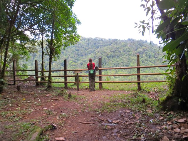
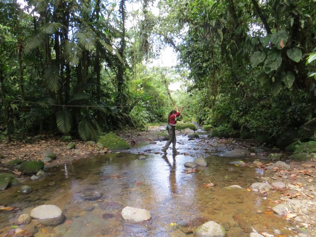
We passed some farms where we saw old rusty vehicles—including an ambulance of the 1940’s—all the way to the confluence of Río Hondura and Río Zurquí. We were very close to the Zurquí Tunnel.
Pasamos fincas y en una vimos vehículos herrumbrados —incluyendo una ambulancia de los años 1940— hasta llegar a la confluencia de los ríos Hondura y Zurquí. Estuvimos muy cerca del Túnel del Zurquí.

At one point, we saw a strange tarp suspended from trees, which read “USAID”, with a high table underneath. Just an odd thing to find in the middle of nowhere…
En cierto momento vimos una tarpa suspendida de los árboles, la cual decía “USAID” y tenía una mesa por debajo. Algo extraño encontrarnos eso en un lugar tan remoto…


Photos/fotos: Miguel Lollett