This hike is only for people who are in excellent shape.
Esta caminata sólo es recomendable para gente que esté en excelente forma.
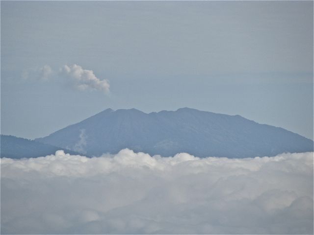
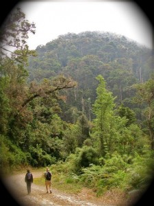
Here’s a view of the volcano from the road to Los Quetzales National Park.
Así se ve el volcán desde la carretera al Parque Nacional Los Quetzales.
PARQUE NACIONAL LOS QUETZALES
LOS QUETZALES NATIONAL PARK
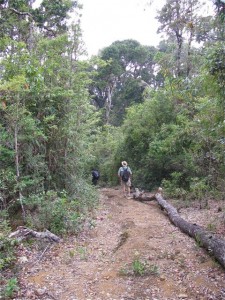
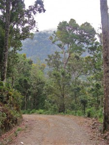
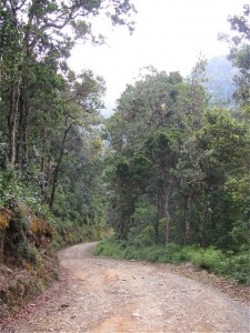
Punta Mona is the last headlands to the south in the Gandoca-Manzanillo Wildlife Reserve on Costa Rica’s southern Caribbean coast. It is roadless, so you can only get there by boat or foot. The area is known for its tropical forest and wetlands. The coast is famous for its coral reefs, dolphins, and sea turtles.
Punta Mona es la última punta o promontorio hacia el sur, en la Reserva de Vida Silvestre Gandoca-Manzanillo en la costa sureña Caribe de Costa Rica.
No posee caminos, por lo cual sólo se puede llegar allí a pie, o en lancha. La zona es conocida por sus bosques tropicales y pantanos, y la costa es famosa por sus arrecifes de coral, delfines y tortugas marinas.
To get to the trailhead, take the road south from Puerto Viejo (Limón province) to the village of Manzanillo (12 Kms). If on foot, you of course can walk the beach instead, but otherwise bike, bus, or car.
From Maxi’s— the best known restaurant in Manzanillo—continue south on a sand road which parallels the beach until the road dead ends. The trail starts just across a small stream to the south of the parking area. Depending on the tides and the rains, you may have to get your feet wet crossing this stream.
Para llegar al inicio del sendero, toma la carretera sur desde Puerto Viejo de Limón hacia el pueblo de Manzanillo (12 Kms.). Si caminas, por supuesto podrías llegar a Manzanillo caminando por la playa, o de lo contrario en bici, bus o auto.
De Maxi’s —el restaurante más conocido en Manzanillo—continúa al sur por un camino de arena paralelo a la playa, hasta que el camino termine. El sendero empieza frente a un pequeño riachuelo al sur del estacionamiento. Dependiendo de las mareas y las lluvias, podrías tener que mojarte los pies al cruzar este riachuelo.
The trail starts off flat and parallels the beach in the shade of the canopy, but soon you are presented with a choice. There is a coastal trail which goes over a series of headlands (puntas) with view points (miradores) and down to small, very pretty beaches. There is also a inland trail which follows farm fencelines. The coastal trail does not go all the way to Punta Mona and you will eventually have to go to the right to join up with the main trail. The main inland trail runs between two fencelines in a cut which is fairly wide. It’s also muddy most of the time.
El sendero empieza plano y paralelo a la playa, en la sombra del canopy, pero luego se te presenta una elección. Hay un sendero costeño que va a una serie de puntas con miradores, y luego baja a pequeñas y lindas playas. También hay un sendero interno que sigue las cercas de las fincas. El sendero costeño no va hasta Punta Mona, así que eventualmente tendrás que usar el sendero principal, el cual va entre dos cercas en un corte bastante amplio (y lodoso la mayor parte del tiempo).
This is a rough hike principally because of the mud. The are lots of short hills, which can be difficult only because they are slippery. About an hour and a half into this hike you will come to a prominent fence corner and the trail splits. Both go downhill to Punta Mona, but the left-hand trail is very wet and muddy. I recommend you go to the right around the fence corner, then downhill to the left.
Esta caminata es difícil, principalmente debido al lodo. Hay muchas subidas, las cuales pueden ser difíciles solamente porque son resbalosas. A una hora y media de iniciar esta caminata, verás una esquina con cercado prominente, y el sendero se divide. Ambos van sendero abajo hasta Punta Mona, pero el de la izquierda es muy mojado y lodoso. Yo recomiendo darle la vuelta a la esquina hacia la derecha y luego para abajo hacia la izquierda.
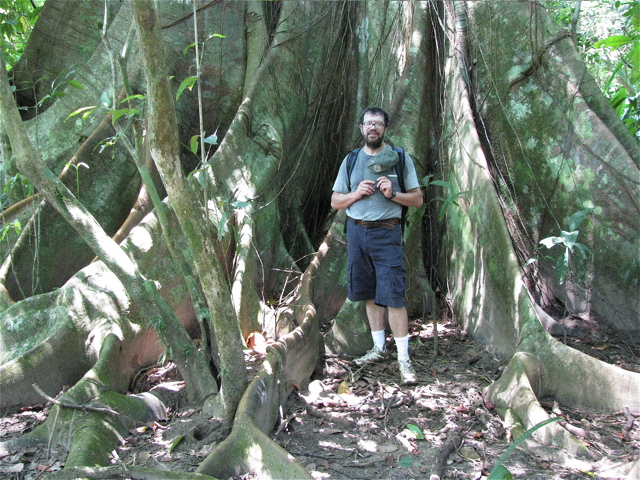
Giant tree - árbol gigante
Reserve about 4 hours for this roundtrip hike in dry season, and more if wet. There is excellent swimming and snorkeling here. You can also get here by boat or kayak, or rent a kayak while at Punta Mona.
Reserva unas cuatro horas ida y vuelta para esta caminata en la estación seca, y más si el suelo está mojado. Aquí hay natación y snorkel excelentes. También puedes llegar aquí en lancha o kayak, o alquilar un kayak en Punta Mona.
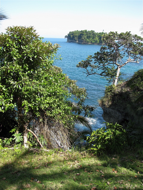
For Information about lodging and camping at Punta Mona:
Información sobre hospedaje y campamento en Punta Mona:
www.puntamona.org
www.costaricabureau.com/nationalparks/gandocamanzanillo.htm
www.costarica.com/places-to-see/parks,-reserves-and-protected-areas/gandoca manzanillo-national-wildlife-refuge/
www.turismoruralcr.com/en/refugiosdevidasilvestre/gandocamanzanillowildliferefuge.html
www.ateccr.org/index.php/tours/description/gandoca_manzanillo_wildlife_refuge/
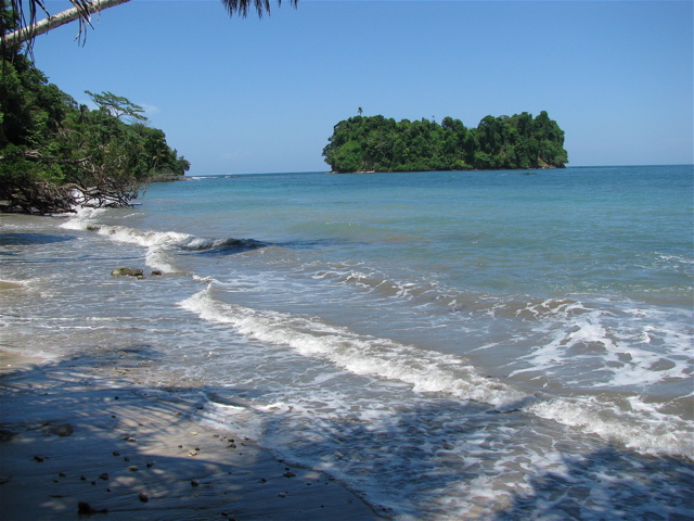
Punta Mona south/sur
Playa Arco is one of the most beautiful beaches in Costa Rica. It is roadless, so you can only get there by foot or by sea. The hike starts at the entrance for Ballena (Spanish for whale) National Park.
To get there, drive south on the Costanera Sur (Pacific Coast Hwy) from Dominical to Uvita. Cross the bridge over the river and drive south about 3 Km to the sign for Playa Ballena, then drive towards the ocean 1 Km on a dirt road, which dead ends at the park ranger’s office. Pay the entrance fee here, check out the map of this and the other park attractions, and listen to whatever warnings the ranger might have for the ocean and tide conditions.
Playa Arco es una de las playas más bellas de Costa Rica. No tiene camino, por lo cual su acceso se limita a pie o mar. La caminata comienza en la entrada del Parque Nacional Ballena.
Para llegar allí, viaja hacia el sur en la Costanera Sur desde Dominical hasta Uvita. Cruza el puente sobre el río y viaja al sur unos 3 Km hasta el letrero para Playa Ballena, y luego viaja hacia el océano 1Km sobre camino de piedra, el cual termina en la oficina de guardaparques. Paga la entrada, revisa en el mapa las diversas atracciones del parque, y escucha cualquier advertencia sobre condiciones de las mareas y el océano.
This is a hike which must be started and completed within a 4 hour time period—two hours before and two hours after low tide. All the ranger stations, area hotels, and the newspaper have tide charts. Better yet, download one before your trip since it’s best to know the tides for all beach walks, especially those with rocks and headlands to cross.
After the ranger station, cross through the campground and hit the beach. Don’t forget sunblock and water. This is not a long walk (20 minutes each way), but it’s also not the easiest beach walk, because you have to cross a large, lose-rock field, and a short but steep headland’s trail. Not a barefoot or flip-flop trek for most of us. Sturdy sandals or sneakers will do fine.
Esta es una caminata que deberá ser completada dentro de un intervalo de 4 horas: Dos horas antes y dos horas después de la marea baja. Todas las estaciones de guardaparques, hoteles de la zona y periódicos tienen los gráficos de mareas. Mejor aún, bájalos de Internet ya que es bueno saber las horas de marea para toda caminata de playa —especialmente aquellas en las que hay que cruzar rocas o cabos.
De la estación guardaparques, cruza el campamento y encuentra la playa. No olvides filtro solar y agua. Esta no es una caminata larga (20 minutos cada dirección), pero no es la caminata más fácil, pues hay que cruzar un gran campo de piedra suelta y un sendero de cabo, corto, pero empinado. Para la mayoría de nosotros, no es una caminata para andar descalzos o en sandalia flip-flop. Está bien usar buenas sandalias o zapatos tenis.
When you get to the beach, make a right (NW), and walk to the end of Playa Ballena. The unmarked trail starts to your right, in a sandy corner up against the hillside—not on the rocks in front of the surf. Walk up and over the headlands, only a few minutes, and exit onto Playa Arco. Take a good look at the trail where you arrive at the beach so you can find it again when you return.
Playa Arco is a wide, flat, kilometer-long beach, sourrounded by steep forested hillside. It has relatively safe swimming. If you arrive with plenty of time to beat the tide change, there are many wonderful, shady spots to relax.
Cuando llegues a la playa, dobla hacia la derecha (noroeste) y camina hasta el final de Playa Ballena. El sendero no está demarcado, pero cominza a tu derecha, en un rincón arenoso contra la ladera —no en las rocas frente al surf. Camina sobre los cabos por algunos minutos, y sal a Playa Arco. Mira bien el sendero cuando llegues a la playa, para que lo puedas encontrar al regreso.
Playa Arco es una playa ancha y plana, de un kilómetro, rodeada de laderas empinadas y boscosas. Nadar es relativamente seguro. Si llegas con suficiente tiempo antes del cambio de marea, hay muchos lugares con sobra donde puedes descansar.
Down the beach about 300 meters, you come to the principal attraction: a walk through the sea cave. Just around the corner from the cave, in a shady corner, is a waterfall, perfect for cooling off or washing the salt and sand away. Enjoy walking the beach, swimming, and checking out the plants and wildlife. Don’t forget to return before the tide gets too high (easy to do in a place this beautiful).
Ballena National Park has many entrances, some with sea caves and arches, and other spots with long beach walks. The other unique geologic attraction of this park of interest to hikers is the Punta Uvita Tombolo, which in fact looks like a giant whale’s tail, and real whales are commonly sited from there. You can access it from the Bahía Uvita or the Colonia (longer hike) entrances. This is best done plus or minus 4 hours from low tide as it becomes an island during high tide. The reef that this marine park protects starts from the far south point, and runs south to The Ballena Island and Tres Hermanas rocks.
Playa abajo unos 300 metros, encontrarás la principal atracción: Caminar en la cueva. Más allá de la cueva, en un rincón sombreado, hay una catarata perfecta para refrescarse o lavarse la sal y arena. Disfruta de la playa, nadar y observar la vida silvestre, pero no se te olvide devolverte antes de que la marea suba demasiado (fácil de hacer en este lugar tan bello).
El Parque Nacional Ballena tiene muchas entradas, algunas con cuevas y arcos, y otras con largas caminatas de playa. La otra atracción geológica de este parque, de interés para el hiking, es el Tómbolo de Punta Uvita, el cual luce como una cola gigante de ballena, y es común citar ballenas reales desde allí. Puedes accesar la lengüeta por las entradas de Bahía Uvita o Colonia (caminata más larga). Es mejor accesar el lugar dentro de las 4 horas antes o después de la marea baja, pues se convierte en una isla durante la marea alta. El arrecife protegido en este parque marino empieza en la punta sur, hacia el sur hasta las rocas Isla Ballena y Tres Hermanas.
Playa Punta Uvita beach
Punta Uvita
Hacienda Barú
Hacienda Barú is one of the oldest ecotourism projects in Costa Rica. The majority of this large property is regulated by MINAE (Ministry of Environment and Energy) under the National Wildlife Refuge system. Payment of the park admission fee gives you access to 7 Km of trails and 3 Km of wild beach open to the public. The trail entrance fees are included in the price of the rooms for their guests.
Hacienda Barú es uno de los proyectos ecoturísticos más antiguos de Costa Rica. La mayoría de esta propiedad es regida por el MINAE (Ministerio del Ambiente y Energía) como Refugio de Vida Silvestre.
El pago de admisión al parque nos da acceso a 7 Km. de senderos y 3 Km. de playa natural abierta al público. La entrada a los senderos está incluida en el precio de las habitaciones para huéspedes.
Hacienda Barú does have some more back country trails, which are only open to guided hikes.
Of the 7 Km of self-guided trails, only the 2.5 Km Lookout Trail (sendero Mirador), is a loop of moderate difficulty. All the other trails are well designed and very easy. This makes it perfect for seniors, families with young children, and those who want to walk slowly and look for wildlife.
Hacienda Barú también tiene senderos internos, los cuales sólo están abiertos para caminatas guiadas.
De los 7 Km. de senderos auto-guiados, sólo el Sendero Mirador, de 2.5 Km. es una vuelta con dificultad moderada. Los demás senderos están bien diseñados y son bastante fáciles, lo cual es perfecto para adultos mayores, familias con niños pequeños, y quienes quieran caminar despacio y ver vida silvestre.
The Refuge combines ocean, wetlands, river, coastal mountain, farmland, and both primary and secondary forest environments. For ambitious hikers, combining all the trail loops with a beach walk to the mouth of the Barú river, will take in all the different terrains and be a great workout. Hacienda Barú is also an excellent place to do a night trail walk, or night beach walk depending on the weather and tides.
El Refugio combina ambientes de océano, pantano, río, montaña costera, finca y bosque, tanto primario como secundario. Para caminantes ambiciosos, se puede combinar todas las vueltas de los senderos con una caminata por la playa hasta la boca del río Barú comprenderá todos los diferentes terrenos, siendo un gran ejercicio. La Hacienda Barú también es un lugar excelente para caminar de noche, o por la playa, dependiendo del clima y las mareas.
Hacienda Barú is located 3 Km north of Playa Dominical on the new Costanera Sur highway from Quepos. Check out their web site for more info on accommodations and tours.
Hacienda Barú está situada 3 Km. al norte de Playa Dominical, por la Costanera Sur que viene desde Quepos. Visite su página web para más información sobre hospedaje y tours.
http://www.haciendabaru.com
Sometimes you see it, sometimes you don’t. However, I strongly recommend being there by opening time at 8:00 a.m.
From the hiking point of view, this is not an important site. However, it’s so much fun to see, and the lagoon is beautiful.
Lo ves, o no lo ves. Por eso recomiendo estar allí a la hora de abrir el parque, a las 8:00 a.m.
Desde el punto de vista del hiking, éste no es un sitio importante. Pero…¡Me encanta verlo! Y la laguna es preciosa.
Cataratas Los Chorros waterfalls
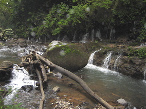
vista Los Chorros
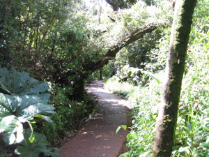
Poás trail - sendero a laguna
LA LEONA is the southern entrance to Corcovado National Park—a 45 minute beach walk from Carate, and the most visited of the entrances since it’s accessible by 4X4 road, collective taxi, or small plane. Many of the lodges in the area have their own trails, and offer guided day hikes into the park.
LA LEONA es la entrada sur al Parque Nacional Corcovado, una caminata por playa a 45 minutos de Carate. Es la entrada más visitada, pues también es accesible por doble tracción, taxi colectivo o avioneta. Muchos albergues en la zona tienen sus propios senderos y ofrecen caminatas guiadas dentro del parque.
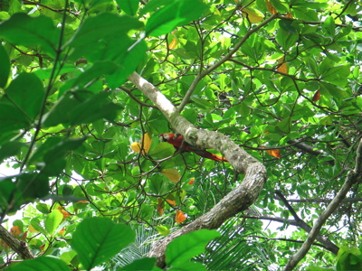
Lapa roja - red macaw
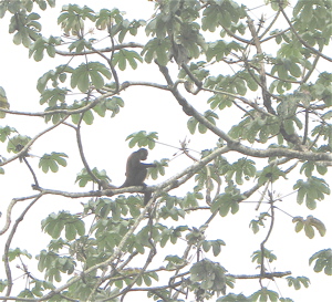
Monkey - mono
From the La Leona entrance there’s a 14 Km trail to Sirena. The trail is a combination of soft sand beach, and forest. Finding the trail entrance from beach to forest can be a problem at times (I hope the park service has improved its marking system since my last visit).
Desde la entrada La Leona, el sendero a Sirena es de 14 Km. y es una combinación de playa de arena suelta, y bosque. A veces cuesta encontrar el sendero desde playa hasta bosque (espero que los guardaparques hayan mejorado el sistema de demarcación desde mi última visita).
Sirena Biological Station - Estación Biológica Sirena
Bunk beds at Sirena - Camarotes en Sirena
You want to leave a lot of time for this hike. It’s not a gentle beach stroll, and there are many river crossings. If it’s raining, the mud and high water will slow you down.
Para esta caminata se necesita bastante tiempo, pues no es una caminata delicada por la playa y, además, hay que cruzar varios ríos. Si llueve, el lodo y los charcos atrasan al caminante.
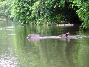
Tapirs - Dantas
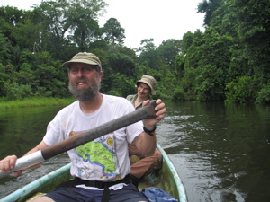
Rich & Mike
At certain river crossings and rocky stretches of beach, you also have to time your hike based on the tides. This timing is difficult for a number of reasons: Your reservation probably won’t coincide with the optimum tide. The hiking time is 7 to 10 hours for most people, making it hard not to have a problem in at least one place, or have to walk softer sand at the very least. For safety, leave enough time to wait out a tide if necessary.
En ciertos cruces de río y trechos rocosos de la playa, uno también puede darse una caminadita si la marea lo permite. Sin embargo, calcular el tiempo para cruzar ríos es dicífil, por las siguientes razones: La reservación que uno hace a veces no coincide con el punto óptimo de la marea. La mayoría de la gente tarda de 7 y 10 horas en hacer esta caminata, e invariablemente tiene problema en por lo menos un lado, o por lo menos debe caminar sobre arena más suelta (lo cual es más lento y difícil). Por seguridad, es mejor dejar suficiente tiempo a que cambie la marea si fuese necesario.
Osa Pics – Fotos en Osa:
SAN PEDRILLO is the northwest entrance to Corcovado National Park, on the Pacific coast. It can be reached by foot from Bahía Drake bay, or directly by boat. From Drake Bay (boat, plane or 4X4) the hike takes 3 to 5 hours.
SAN PEDRILLO es la entrada noroeste del Parque Nacional Corcovado, en la costa Pacífica de Costa Rica. Se puede llegar a pie desde Bahía Drake, o directamente por lancha. De Drake (en lancha, avión o doble tracción), la caminata es de 3 a 5 horas.
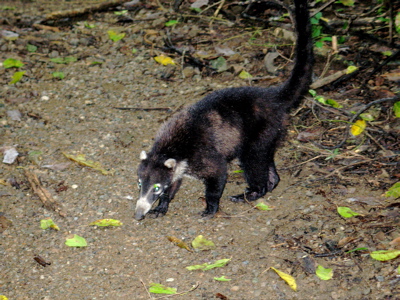
Pizotes are everywhere - Pizotes andan por todo!
There are a number of lodges and tent camps along this trail. The trail is a combination of beach and forest with some up and down over headlands. The forest becomes big and impressive when you cross into the park before arriving at San Pedrillo.
Hay varios albergues, pensiones y campamentos en el camino. El sendero es una combinación de playa y bosque, con subidas y bajadas. El bosque se hace amplio e impresionante al cruzar al parque antes de llegar a San Pedrillo.
At the San Pedrillo station there is camping but no food service. The trail to Sirena from here is very long—28 Km., much of it on the beach with little or no shade. The first 7 Km. is up over forest highlands with a steep descent to Llorona Beach. There is a waterfall and sea arch a short distance up the beach to the north.
En la Estación San Pedrillo hay camping, pero no hay servicio de comida. El sendero a Sirena desde acá es bastante largo —28 Km.— la mayor parte por la playa, con poca o ninguna sombra. Los primeros 7 Km. son por bosque con bajada empinada a Playa Llorona. Hay una catarata y arco a corta distancia de la playa, al norte.
Mike & Ornit
Here also is the first major river crossing. Plan to cross in the 3 hour window before and after low tide, and watch for crocodiles.
Allí hay que cruzar el primer río caudaloso, lo cual recomiendo hacer dentro de las 3 horas antes o después de la marea baja, y echándole ojo a los cocodrilos.
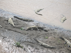
Croco-diles = coco-drilos
The next river crossing is the Río Corcovado, 8 Km. south along Playa Llorona. It’s a fast hard-sand hike, and you must cross both rivers in your low tide window mentioned before.
Luego hay que cruzar el Río Corcovado a 8 Km. al sur de Playa Llorona. La caminata es rápida por arena dura, pero debes cruzar ambos ríos en la ventana de oportunidad que mencioné anteriormente.
The hike from here to the Río Sirena river gradually gets more difficult as it turns into a loose sand hike. The Sirena river is deep and has crocodiles. From here, it’s a 2 Km. beach+air strip, or trail hike to the San Pedrillo station.
La caminata desde este punto hasta el Río Sirena gradualmente se hace más difícil, pues la arena es suave. El Río Sirena es profundo y lleno de cocodrilos. De aquí son 2 Km. por playa abierta, o por sendero, hasta la Estación San Pedrillo.
It’s very hard to hit all three rivers at low tide, and balance that against daylight. For that reason, I recommend doing this hike south to north (Sirena to San Pedrillo) unlike how Mike and I did it.
Lo difícil de esta caminata es tener que cruzar los 3 ríos en marea baja, cuidándose de hacerlo en la luz del día. Por esta razón, recomiendo hacerla de sur a norte (de Sirena a San Pedrillo) en vez de la manera en que Mike y yo la hicimos.
Desde Sirena, uno puede pedirle a los guardaparques o voluntarios, que le crucen el Río Sirena en marea alta, o de noche. Si la marea es favorable, lo mejor es salir entre las 2:00 y las 4:00 a.m.. Así, uno cubre la caminata en arena suave durante la noche, cuando hace menos calor.
From Sirena, you may be able to get one of the park rangers or volunteers to row you across the Sirena river at high tide and at night. If the tides were favorable, a 2:00 to 4:00 a.m. departure would be best. That way you would cover the loose sand portion of the hike in the night or cool off early morning.
It’s a long day, but there is time to rest and wait out a tide. For those hiking light (without camping gear), it’s also enough time to reach a lodge or tent camp at Playa San Pedrillo or Playa San Josecito. From there you can catch a boat to Sierpe, or walk to Drake Bay.
Es un día largo, pero hay tiempo para descansar o esperar la marea. Para quienes viajan sin mucho equipaje, también hay tiempo de llegar a algún albergue en Playa San Pedrillo o San Josecito. De ahí se puede tomar lancha a Sierpe, o caminar hasta Bahía Drake.
Hola!
Ornit is very proud! - Ornit se siente orgullosa!
Occupying a big chunk of the Osa Peninsula in the southeastern Pacific side, Corcovado National Park is one of the best destinations for hiking, wildlife, big trees, and biodiversity. In my opinion, it is the jewel in the crown of the national park system.
El Parque Nacional Corcovado ocupa gran parte de la Península de Osa en la costa Pacífica y es uno de los mejores destinos para caminatas, donde se ven animales y plantas, grandes árboles y se disfruta de la biodiversidad de formas. En mi opinión, es la corona del sistema de parques nacionales.
Trail in Los Patos sector - Sendero en sector Los Patos
Corcovado has three long-distance trails open to the public, all three ending at Sirena Biológica Station, which also has a system of local trails surrounding it. All three entrances have day hike possibilities both inside and outside the park boundary. To do any of the distance hikes requires advanced reservations, good physical condition, and a lot of preparation. All three trail heads are tough to get to.
Corcovado ofrece tres senderos de larga distancia abiertos al público, los cuales terminan en la Estación Biológica Sirena, también rodeada de su propio sistema de senderos locales. Las tres entradas ofrecen posibilidades de caminatas tanto dentro, como fuera del parque. Para hacer las caminatas de larga distancia hay que hacer reservaciones con antelación, estar en muy buena condición física, y hacer muchos preparativos. Los comienzos de los tres senderos son difíciles de alcanzar.
Great butress/ gamboa grande
La entrada al sendero LOS PATOS es la única hacia adentro —12 kilómetros al oeste del pueblo de La Palma. El camino (4X4 solamente) cruza el Río Rincón 26 veces y solamente debe intentar hacerse durante la marea baja. El camino en sí ofrece poder hacer caminata y ver pájaros si a uno no le importa andar con los pies mojados.
From the road you see entrances to Danta Corcovado Lodge (info@dantacorcovado.net), the Guaymí indigenous reserve, and ends at Albergue Cerro de Oro (www.turismorural.com). All have lodging and their own trails. The parking lot for Los Patos is on the right, 2 Km. before the end of the road.
El camino pasa frente al albergue Danta Corcovado Lodge (info@dantacorcovado.net), la Reserva Indígena Guaymí y termina en el Albergue Cerro de Oro (www.turismorural.com). Todos estos ofrecen hospedaje y sus propios senderos. El estacionamiento de Los Patos está hacia la derecha, a dos Km. antes que termine el camino.
Danta Corcovado Lodge
From the parking lot it’s a 2 1/2Km. trail to the park entrance. Los Patos has a campground, but no food service.
Del estacionamiento, hay un sendero de 2 1/2 Km. hasta la entrada del parque. Los Patos tiene zona de acampar, pero no ofrece comida.
From here, it’s another 17 Km. to Sirena, with about half the hike in hilly terrain and the other half in the lowlands. If wet, expect it muddy and slippery. Dry season is a better time to do this hike, which is entirely an inland hike through the wild center of the park. There are big trees, wildlife, and shade. Start very early if you want to arrive at Sirena before dinner.
De aquí son 17 Km. hasta Sirena, con media caminata sobre terreno colinero y la otra mitad por tierras bajas. Si ha llovido, estará resbaloso y con lodo. Es mejor hacer esta caminata durante la estación seca, pues es una caminata enteramente por el centro del parque. Hay grandes árboles, vida silvestre y sombra. Hay que empezar muy temprano si se quiere llegar a Sirena antes de la cena.
Rich con amigos Ornit & Mike
Driftwood/Madera a la deriva