Category Archives: Hiking Costa Rica

HACIENDA BARU

Hacienda Barú


Hacienda Barú is one of the oldest ecotourism projects in Costa Rica. The majority of this large property is regulated by MINAE (Ministry of Environment and Energy) under the National Wildlife Refuge system. Payment of the park admission fee gives you access to 7 Km of trails and 3 Km of wild beach open to the public. The trail entrance fees are included in the price of the rooms for their guests.

Hacienda Barú es uno de los proyectos ecoturísticos más antiguos de Costa Rica. La mayoría de esta propiedad es regida por el MINAE (Ministerio del Ambiente y Energía) como Refugio de Vida Silvestre.

El pago de admisión al parque nos da acceso a 7 Km. de senderos y 3 Km. de playa natural abierta al público. La entrada a los senderos está incluida en el precio de las habitaciones para huéspedes. 

 Baru

Hacienda Barú does have some more back country trails, which are only open to guided hikes. 

Of the 7 Km of self-guided trails, only the 2.5 Km Lookout Trail (sendero Mirador), is a loop of moderate difficulty. All the other trails are well designed and very easy. This makes it perfect for seniors, families with young children, and those who want to walk slowly and look for wildlife. 

Hacienda Barú también tiene senderos internos, los cuales sólo están abiertos para caminatas guiadas.

De los 7 Km. de senderos auto-guiados, sólo el Sendero Mirador, de 2.5 Km. es una vuelta con dificultad moderada. Los demás senderos están bien diseñados y son bastante fáciles, lo cual es perfecto para adultos mayores, familias con niños pequeños, y quienes quieran caminar despacio y ver vida silvestre.  

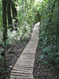
 Baru trail          Baru trail 2

The Refuge combines ocean, wetlands, river, coastal mountain, farmland, and both primary and secondary forest environments. For ambitious hikers, combining all the trail loops with a beach walk to the mouth of the Barú river, will take in all the different terrains and be a great workout. Hacienda Barú is also an excellent place to do a night trail walk, or night beach walk depending on the weather and tides.

El Refugio combina ambientes de océano, pantano, río, montaña costera, finca y bosque, tanto primario como secundario. Para caminantes ambiciosos, se puede combinar todas las vueltas de los senderos con una caminata por la playa hasta la boca del río Barú comprenderá todos los diferentes terrenos, siendo un gran ejercicio. La Hacienda Barú también es un lugar excelente para caminar de noche, o por la playa, dependiendo del clima y las mareas.

 Baru Playa

Hacienda Barú is located 3 Km north of Playa Dominical on the new Costanera Sur highway from Quepos. Check out their web site for more info on accommodations and tours.

Hacienda Barú está situada 3 Km. al norte de Playa Dominical, por la Costanera Sur que viene desde Quepos. Visite su página web para más información sobre hospedaje y tours.

http://www.haciendabaru.com

WILSON GARDENS – JARDINES WILSON

Lodging Las CrucesWilson Gardens – Las Cruces  OTS (Organization For Tropical Studies)

I will not repeat here what you can see on the OTS website:  http://www.esintro.co.cr or    http://www.ots.ac.cr

This is a fabulous park in the Southern Zone near San Vito. It’s most frequented by botanists and birders, but has excellent trails for hikers also. If you are looking for athletic or challenging hiking, you will be better off up at La Amistad National Park.

Wilson Gardens has garden and forest trails that go from easy strolls to moderate two-hour rambles. This is good since it’s not easy to find trails for less ambitious walks in the mid-elevation forests of Costa Rica.

What is of true interest to hikers here is the Rio Java trail. Big trees, beautiful plants, wildlife and a clean river with swimming holes are some of the attractions on this trail. If you go during wet season you may want to pack some water shoes, sandals or flip flops to explore the trails and primary forest on the north side of the Rio Java.

Wilson Gardens, unlike the OTS La Selva Reserve, has a day entrance fee that is not mentioned on their website. It’s $8 for foreigners and $3 for Costa Ricans and it is not required that you go with a guide. It’s located 6Km above San Vito on the road to Ciudad Neilly near the southern border with Panama.

senderos - trails

senderos - trails

Wilson Birder

Jardines Wilson – Las Cruces  OET (Organización de Estudios Tropicales)

No quiero repetir aquí lo que se puede ver en el portal web de la OET:

http://www.esintro.co.cr ó    http://www.ots.ac.cr

Este es un parque fabuloso en la Zona Sur, cerca de San Vito. Es frecuentado por botánicos y observadores de pájaros, pero también tiene senderos excelentes para caminantes. Si buscas caminatas atléticas o retadoras, sería mejor que fueras al Parque Nacional La Amistad.

Los Jardines Wilson tienen senderos de jardín y bosque, los cuales van desde caminatas fáciles, hasta trechos moderados de dos horas de duración, lo cual es bueno, porque no es fácil encontrar senderos para caminatas menos ambiciosas en los bosques costarricenses de elevación media.

El sendero Río Java es el más interesante para hiking, por sus grandes árboles, vegetación hermosa, vida silvestre y río limpio con pozas para nadar. Si vas durante la estación lluviosa, deberías pensar en llevar zapatos de agua, o sandalias para explorar los senderos y bosque primario en la parte norte del río Java.

La tarifa de entrada a Jardines Wilson no se menciona en el sitio web de la OET (como sí mencionan a la Reserva La Selva). La entrada cuesta $8 para extranjeros y $3 para nacionales, pero no requiere que vayas con guía. Se encuentra a 6Km más arriba de San Vito, en la carretera a Ciudad Neilly, cerca de la frontera con Panamá.

Cabina Wilson - Wilson Cabin

Cabina Wilson - Wilson Cabin

Río Java

Río Java

Wilson Strangler

Golfito area: Cataratas y Senderos Avellán: Zona de Golfito

Cataratas y Senderos Avellán

If you’re in Golfito looking to do some hiking, check out the trails and waterfalls at “Cataratas y Senderos Avellán”. Only 6 km north of the Depósito Libre, they have a variety of trails, clean waterfalls with good pools for bathing, a tarzan swing, canopy tour, covered jungle camping,

rooms and a full service restaurant with good typical country food. Great for birders and botanists.

I went with friend, Ted, with the intention to add to my collection of waterfalls, and I was not disappointed. The hiking/waterfall tour is $5 and includes a knowledgeable guide, swim beneath the waterfall, and a swing through the jungle like Tarzan and Jane. 

The main trails are well made, and relatively easy. For those with more ambition and time, there is a more difficult 6 Km loop. The water here is crystal clear and the bathing is perfectly refreshing for a hot jungle zone. The property has a combination of farm, and secondary and primary forest. It straddles the Gamba River and is adjacent to Piedras Blancas National Park. We did not stay overnight, but it looks like a great place for wildlife if you did the Jungle camp, or the rooms at the homestead.

Getting There: From the north side of the Depósito Libre (tax free market) in Golfito, turn right at the corner before the technical high school. Go 6 Kms on a hilly gravel road. You’ll see the restaurant and sign on the left side of the road.

There is poor phone service out there, but they do have a web site:    www.avellancr.com


Senderos Avellán trails

Senderos Avellán trails


Si estás en Golfito y te gustaría hacer una caminata, vale la pena que visites las “Cataratas y Senderos Avellán”, a sólo 6 Km al norte del Depósito Libre. El lugar ofrece variedad de senderos, cataratas limpias con buenas pozas para bañarse, un columpio estilo Tarzán, tour de canopy, campamento de jungla cubierto, habitaciones y restaurante con servicio completo de comida típica. Es ideal para observadores de pájaros y botánicos. 

Fui con mi amigo Ted, con la intención de ensanchar mi colección de cataratas, y no me decepcionaron. El tour para hiking y la catarata cuesta $5 e incluye guía bastante conocedor de la zona, bañarse bajo la catarata y un columpio en medio de la jungla, como el de Tarzán y Jane. 

Los senderos principales están bien hechos y son relativamente fáciles. Para quienes tengan más ambición y tiempo, hay una curva más difícil, de 6Km.

Allí, el agua es cristalina y bañarse es refrescante en medio de la jungla caliente. La propiedad consiste de una combinación de finca y bosque primario y secundario, los cuales hacen puente sobre el Río Gamba y están a la par del Parque Nacional Piedras Blancas.

No nos quedamos la noche, pero parece ser un lugar ideal para vida silvestre, si te quedaras en el campamento de jungla, o en las habitaciones de la finca.

Para llegar: Del lado norte del Depósito Libre en Golfito, doblar a la derecha en la esquina antes del colegio técnico, y seguir 6 Km por calle inclinada sin pavimentar. Verás el restaurante y letrero del lado izquierdo del camino. 

Hay mal servicio telefónico, pero sí tienen portal web:         www.avellancr.com


Poza Avellán pool

Poza Avellán pool


Avellán Catarata

Avellán Catarata


Columpio - swing

Columpio - swing

POTREROS

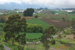
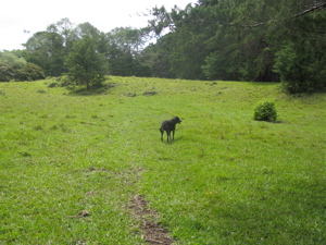
A potrero is a meadow where “potros” (colts) graze.

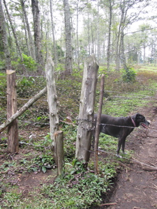
Costa Rica offers many opportunities to walk and picnic on these private lands. If there’s a pedestrian gate, chances are it’s okay to trespass.


Rich at entrance - en la entrada    

Rich at entrance - en la entrada


Costa Rica ofrece muchas oportunidades de caminar y hacer picnic en potreros privados. Si hay un portón para caminantes, lo más probable es que se pueda entrar sin requerir permiso.


Potrero in the Cartago area

Potrero in the Cartago area


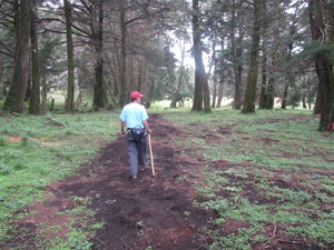
 Sil and I usually walk around our potrero every morning, which is her only opportunity to exercise (she tends to be stationary doing art all day long).

Sil y yo usualmente vamos a caminar por el potrero todas las mañanas, siendo ésta la única oportunidad de que ella haga ejercicio (ella tiende a sentarse todo el día a hacer su arte).


Sil on the uphill - Sil en la subida

Sil on the uphill - Sil en la subida


Rich walking

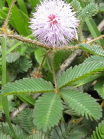
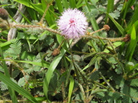
Potreros usually have “dormilonas” (sleepers), which are plants whose leaves close when you touch them. “Our” potrero just had dormilonas in bloom with their cute purple puff. Another comon plant is Santa Lucía, which blooms mostly in January. “Santa Lucía en enero, pa que no falte el dinero” (Santa Lucia is given to people in January, and you must put it inside your wallet so it’ll attract money all year round).

Los potreros casi siempre están llenos de dormilonas (plantas cuyas hoja se cierran al tocarlas). “Nuestro” potrero tuvo dormilonas en flor hace poco. Otra planta común en la Santa Lucía, la cual florece especialmente en enero.


Dormilona - Sleeper

Dormilona - Sleeper

Dormilona

Dormilona


Santa Lucía

Santa Lucía


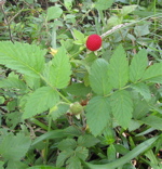
Frambuesa is a wild boisenberry. In Costa Rica it’s common to see the plants with blooms and berries all year round. There’s also wild blackberries in our area.

En Costa Rica es común ver las frambuesas con flor y fruta todo el año. También hay moras silvestres en nuestra zona. 


Frambuesa

Frambuesa


Now you know where the locality of “Potrero Cerrado” (Closed Meadow,) in Cartago, gets its name!

Ya sabes de dónde viene el nombre de “Potrero Cerrado” de Cartago!  


vista Potrero Cerrado de Cartago

vista Potrero Cerrado de Cartago


Look at the V space next to the actual gate.  This is very common in Costa Rican potreros.

Observa la entrada en V a la par del portón. Esto es muy común en los potreros ticos.


V entrance

V entrance


More potrero pics – Más fotos de potrero:

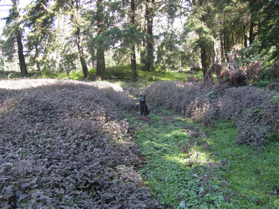
Bandit in potrero

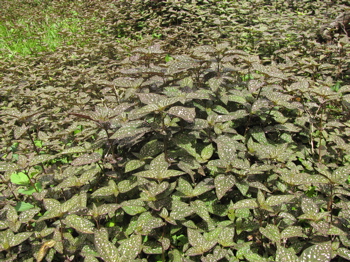
Coleous field

Coleous field

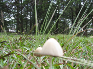
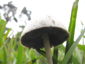
Mushrooms at potreroShroomSendero potrero

Bandit

RAIN GEAR – EQUIPO PARA LLUVIA

The other day I was scanning articles about Costa Rica in the archives of Outside Magazine, and I came upon one in which a traveller asks for gear advice for an upcoming trip to Costa Rica. The question was about rain gear and footwear for hiking in a rainy climate. Now, I have a lifetime of almost everyday hiking and 15 years of year-round hiking and guiding in Costa Rica, but I am definitely not a gear head or equipment junkie, so I can’t comment on whether the Outside advisor’s recommendations were good, or not. What struck me was how differently I would try to answer that question.

El otro día estaba revisando artículos sobre Costa Rica en los archivos de Outside Magazine, cuando me topé con uno en el cual un viajero preguntaba sobre equipo de lluvia y zapatos para hiking en clima lluvioso. Si bien, tengo toda una vida de caminar casi a diario y 15 años de caminatas y guiar todo el año en Costa Rica, no estoy obsesionado con ningún “equipo”, así que no puedo hacer comentarios en cuanto a si las recomendaciones de la revista eran buenas, o malas. Lo que sí me impactó fue cuán diferente habría sido mi respuesta a la pregunta del viajero.


My answer would be based not so much upon the performance of the gear as to the health and safety of the hiker. To me, this means that rain gear must protect you from getting hypothermic while on the trail in rainy conditions, and footwear should keep you from falling (as best can be expected) in a country known for steep and slippery trails.

Mi respuesta se habría basado no tanto en la actuación del equipo, sino en la salud y seguridad del caminante. Para mí, esto significa que el equipo impermeable deberá protegerte para que no te dé hipotermia en un sendero con condiciones lluviosas, y tus zapatos deberán prevenir que te caigas (dentro de lo posible) en un país famoso por sus senderos empinados y resbalosos.


"Sombrilla de pobre" - This plant is called, "Poor Man's Umbrella"

"Sombrilla de pobre" - This plant is called, "Poor Man's Umbrella"


RAIN GEAR:  Costa Rica is one of the wettest countries on the planet. Naturally, it depends on where you are hiking on what day. The elevation goes from 0 to 3800 meters (12000 feet) in a very short distance from both oceans. People are often shocked at how cool it can be when they are expecting “tropical.”

EQUIPO DE  LLUVIA:  Costa Rica es uno de los países más mojados del planeta. Naturalmente, todo depende de dónde estés caminando en algún día determinado. La elevación va desde 0 a los 3800 metros (12000 pies) en poca distancia de ambos océanos. La gente a menudo se sorprende de cuán fresco puede ser, cuando estaban esperando clima “tropical”.


When it rains, the temperature can drop quickly. Even at sea level you can get chilled if your body temperature is not high and you are wet. At mid to higher elevations you can definitely get hypothermia. There is no one answer for all situations, which unfortunately, the traveller who wants to pack light, wants to hear. Will a breathable fabric work in 100% humidity, two inch per hour downpour, while you’re sweating profusely? Will vents help? I can’t say, because I haven’t tested rain gear, but my basic science classes from way back taught me that if you’ve got 100% moisture inside and out, then you’re wet. Period.

Cuando llueve, la temperatura puede bajar rápidamente. Incluso a nivel del mar puedes enfriarte si tu temperatura no es alta y estás mojado(a). A temperaturas media y alta, definitivamente te puede dar hipotermia. No hay una sola respuesta para toda situación, aunque el viajero que empaca liviano, desafortunadamente, quisiera saberla. Una tela que respire, ¿servirá en 100% humedad, aguacero de 5cm por hora, mientras sudas profusamente? ¿Servirá tener respiraderos? No puedo responder, porque no he probado ese equipo de lluvia, pero mis clases básicas de ciencias hace años me enseñaron que si tienes 100% humedad adentro y afuera, ¡te mojaste! Punto.


Tirimbina wet stairs - peldaños mojados en Tirimbina

Tirimbina wet stairs - peldaños mojados en Tirimbina


These stairs are a perfect example of trail conditions we don’t think about—we just climb or descend! Obstacles and difficulties are part of hiking.

Estos peldaños son el ejemplo perfecto de condiciones en el sendero, las cuales no pensamos encontrar y, sin embargo, subimos o bajamos sin darle importancia. Obstáculos y dificultades son parte del hiking.


What’s important is that you stay warm. At low to mid elevations any reasonably good raincoat will do the trick. At higher elevations you’d better have something to put on under the raincoat—like a pile sweater—and get it on early when you are still warm. If you are backpacking, remember to protect your dry change of clothing with garbage bags or a backpack cover, and change into dry stuff immediately when you arrive. Don’t wait for your body temperature to drop. If you are day hiking, have a change of clothing ready in the car or room.

Lo importante es mantenerte tibio. A elevaciones entre bajas y medianas, cualquier buen impermeable te ayuda. A elevaciones más altas, deberás ponerte algo debajo del impermeable —como un suéter— y ponértelo antes de que te enfríes. Si estás mochilando, acuérdate de proteger tu muda seca dentro de bolsas de basura, y cámbiate de ropa apenas llegues. No esperes a que baje la temperatura de tu cuerpo. Si caminas por un día, mantén una muda lista en el auto o habitación.


Depending on the temperature and season at lower elevations, you may choose to just get wet. If the hike is not too long or the weather has been really hot, that may work. Many people travel with quick drying clothing. Pack a big zip-lock bag to protect your camera, passport, and wallet. Umbrellas work great with two exceptions: Too much wind turns them into a sail, and narrow brushy trails with low branches will catch and tear the umbrella.

Dependiendo de la temperatura y estación a elevaciones bajas, podrías optar por mojarte. Si la caminata no es muy larga y el clima ha estado bien caliente, tal vez eso sirva. Mucha gente viaja con ropa que seca rápido. Empaca una bolsa zip-lock para proteger la cámara, el pasaporte y la billetera. Los paraguas funcionan, con dos excepciones: Demasiado viento los convierte en vela, y en senderos con ramas bajas se te pega el paraguas y se te rompe.


FOOTWEAR: This is a subject we could probably write a book about, and I have seen it all over the years. Porters in Nepal or Peru may be comfy in flip flops, but you may be taking a big risk. Likewise with high heels or barefoot (there are burs, thorns and biting critters). Campasinos are born and raised in cheap rubber knee boots and almost never fall on slippery trails, but this may lack support and traction if you’re not used to it. To me, the most important thing is to protect your feet and avoid falling. Wet shoes, hot feet, performance, weight, drying time are all good but secondary issues. I’d rather hike all day in wet shoes than risk a cut or broken toe on a difficult river crossing. It’s better to pack the extra weight of a hiking boot you trust for tread and support, than to fall on a muddy trail due to worn out sneakers.

CALZADO:  Este es tema para escribir un libro, lo cual he visto a través de los años. Los porteros en Nepal o Perú andan felices en sandalias, pero en sandalias tú corres un gran riesgo. Igual en tacones altos, o andando descalzos (hay mozotes, espinas y criaturas que muerden). Los campesinos crecen usando botas de hule baratas y casi nunca se caen en senderos resbalosos, pero tal vez les falte soporte y tracción si no estamos acostumbrados a usarlas. Para mí, lo más importante es protegerme los pies y no caerme. Zapatos mojados, pies calientes, actuaciones, peso y tiempo de secado son asuntos secundarios. Prefiero caminar todo el día con zapatos mojados, que arriesgarme a una cortada, o quebrarme un dedo en una cruzada de río. Es mejor empacar el peso extra de una bota de hiking que te guste por su rodadura y soporte, que caerse en el barro por andar en tennis viejas.


Costa Rican trails often do not have bridges, and rarely have switch backs.  If you are going to more adventurous trails, you can expect steep and slippery, even in dry season. Even in more moderate “civilized” parks, trails can be slime covered but not very visible, walkways, roots, and rocks.  The combination of a sticky rubber, good tread pattern, and for some of us, ankle support, works best. It’s the downhill that’s dangerous and that’s what you have to prepare for.

Los senderos costarricenses a menudo no tienen puentes y casi nunca tienen cambioatrás. Si vas a senderos más difíciles puedes esperar que sean empinados y resbalosos, incluso en la estación seca. Incluso en los parques más “civilizados”, los senderos pueden estar cubiertos de lodo sin ser visible, o tener pasadizos, raíces salidas, y rocas. La combinación del agarre del hule, buen patrón de rodadura y, para algunos como yo, buen soporte de tobillo, es lo mejor. Es la cuesta abajo la que es peligrosa y para eso es que debemos prepararnos.


sendero-cahuita.thumbnail On the trail there is no substitute for caution.  Wood that you step on may be slippery or rotten, whether it’s natural roots, a fallen log,  or a constructed walkway. Earth trails may be slick clay or loose mud. Rocks should be tested before putting too much trust in them.  Some folks like walking sticks and they can be a great help. I have seen people put too much weight on them and they too can slide  out. On some hikes it’s worth the extra weight to pack a pair of water shoes or sandals for river crossings. If packing light for your  trip is not an issue, and you have a car or home base to hike from, you can bring down a variety of footwear so you can test what  works. Let me know if you find the perfect footwear.

 Al caminar hay que tener cuidado. La madera en que te paras puede estar resbalosa o podrida, ya sean raíces, un tronco caído, o un  pasaje construido.  Senderos de tierra pueden ser de arcilla resbalosa, o lodo flojo. Hay que probar cuándo puedes pararte en las rocas.  Hay gente que usa bastones, los cuales ayudan y, sin embargo, he visto gente que pone demasiado peso en ellos y se les tuercen. En algunas caminatas vale la pena tener zapatos de agua, o sandalias, para curzar ríos. Si no necesitas empacar liviano y tienes una casa o base desde dónde empezar, puedes traer variedad de calzado para probar qué te sirve. Cuéntame si encuentras el calzado perfecto.

trail near Steinvorth's property

trail near Steinvorth's property

SMALL GUIDED TRIPS – CAMINATAS CORTAS


Irazú

Irazú

Here are some possible trip itineraries based on your short time schedule. The emphasis, of course, is on hiking, but we always mix other activities so it just depends on how much you value those activities and the weather on the day we have it planned. Some of the activities are:

 • Hot springs

• Swimming: Ocean, rivers, plunge pools beneath waterfalls (my favorite).

• Snorkelling: Often means renting a boat to an island and depends on the roughness of the sea that day.

• Beach camping (I have all necessary stuff).

• Long beach hikes: Hot and sunny, but also possible at night. 

• Light Backpacking: Hut to hut but no services at huts except mattresses, cooking stuff, and cooking fuel. We carry food, clothes, sleeping sacks, and rain gear. 


• North West trip:   Volcan Tenorio: Stay at community co-op lodge and reserve. Hike their trails to a laguna high on the volcano. This is rainforest/cloud forest terrain and there is no trail to the summit as far as I know.


• Rincón de la Vieja National Park: The park campground is closed so we would have to stay at hotels nearby. Hiking to the summit of this active volcano is a full day, weather permitting. This park has another full day’s worth of hiking to waterfalls and geothermal attractions that are not weather dependent. Great trees and wildlife, too. The local lodges are on large ranches with their own trails systems.


• Santa Rosa National Park: Beach camping in the national park, and finding local fisherman in village to take us snorkelling to remote coves and islands on north shore of park. Some snorkelling from rocky points of the beach also. Not a touristy area, but the campground is a zoo on weekends and holidays.


• Monteverde: Quaker-founded community high in the western mountains. Very touristy, which is hard to believe since the trip into Monteverde is tough and the principle activity is nature. It’s also a very artsy town. It offers two large reserves, and many smaller ones—all with trails. This is cloud forest country. Here we can do the hut to hut hike, day hike in the reserves staying at local lodges, or light backpack into a biological research station that takes paying guests and has a great view of Volcán Arenal. Monteverde can be combined with one of two possible beach trips:


•a) Central Nicoya: Stop at Barra Honda National Park to do some caving. This trip is with local indigenous guides. Hour and a half hike in. Hour decent and tour of cave, and hour and a half back to park headquarters. Guides are very knowledgeable about local plants and animals.    barra-honda-4.thumbnail   

• Nosara beaches: long beach hikes, maybe some river kayaking or snorkelling.  


•b) Southern Nicoya:  This trip can be combined with Monteverde, or can be its own trip, because there is lots to do. The trails are moderate to difficult and the temperature will be hot. Taking a ferry across the gulf of Nicoya is both pleasant and a hassle. 

• Curú: Private reserve on a working farm. Primitive but beach front cabins. Trail system, lots of wildlife, sea kayaks and snorkelling.

• Montezuma: Principle tourist town of the area. Great waterfalls and long beach hikes.

• Cabuya: Beach camping, sea kayaking and snorkelling

• Cabo Blanco Absolute Reserve: One day worth of hiking. Dry forest.


High Mountains and the beaches of South-Central coast : 

• Cerro de la Muerte: Hiking in oak forest 1900-3000 meters elevation. Chance to see Quetzals.

• San Gerado de Rivas-Chirripó National Park: Highest peaks in the country at 3800m. Not possible as a day hike, and reservations for refugio at timberline are hard to get. The summit is not practical for short trips, but this area is great for day hikes from the town and not very touristy.

• Playa Dominical to Ballena National Park: Hike to waterfall with great swimming, long beach walks, snorkelling, sea caves.


Possible day trips from my house:

• Volcán Poás National Park: World’s largest active crater. Cloud forest hike to old crater. This hike is easily combined with Los Chorros waterfalls.  
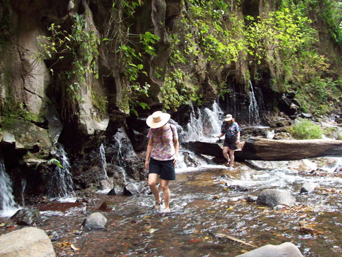
Los Chorros

Los Chorros

 • Volcán Barva National Park:  Is a dormant volcano and clould forest, 2800m elevation.

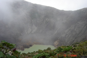
• Volcán Irazú National Park: Highest volcano in country, active, 3424m, tourists drive to crater but there is a trail from park halfway up. I usually combine this hike with a visit to Lankester Botanical Gardens. 
Lankester Gardens

Lankester Gardens

Jardines Lankaster belongs to University of Costa Rica

Jardines Lankaster belongs to University of Costa Rica


• Volcán Turrialba National Park: Active, and some days it has restricted access. 3400m. Hike up on jeep road. Trail goes down into crater bottom which is mostly dry.

• Tapantí National Park: Beautiful scenery and plants. Mid elevation rainforest.

• Pico Blanco: Hike with views of central valley (San José urban sprawl).

• Cloud Forest and waterfalls in my neighborhood: Combination hike of rural roads and primitive trails.


ESPAÑOL

He aquí algunos de los posibles itinerarios de viaje, basados en tu estadía corta. El énfasis es, por supuesto, en hiking, pero siempre mezclamos otras actividades; todo depende de tu interés en ellas y en el estado del tiempo para el día en cuestión.  Dichas actividades incluyen:

• Balnearios termales.

• Natación: Océano, ríos, pozas bajo cataratas (¡mis favoritas!) 

• Snorkel: A menudo significa tener que alquilar un bote a una isla, y depende de la actividad del mar ese día.

• Campamentos de playa: Tengo todo lo necesario para hacerlos.

• Largas caminatas de playa: Con calor y sol, pero también se pueden hacer de noche.

• Expedición liviana: De rancho a rancho, pero sin servicios excepto colchones, enseres de cocina, y gas para cocinar. Nosotros llevamos comida, ropa, bolsas de dormir  e impermeables. 


• Viaje al noroeste: Volcán Tenorio: Nos quedamos en albergue cooperativo y reserva. Caminata por sus senderos a una laguna arriba en el volcán. El terreno es de bosque lluvioso/nuboso, donde si no me equivoco, no existe sendero a la cumbre. 


• Parque Nacional Rincón de la Vieja: El área de campamento está cerrada, pero nos podemos hospedar en hoteles cercanos. Caminar a la cumbre de este volcán activo nos toma todo el día, si el clima lo permite. El parque tiene otra caminata de todo un día a cataratas y atracciones geotermales, la cual no depende del clima. También hay árboles y vida silvestre increíbles. Los albergues locales están en haciendas que cuentan con su propio sistema de senderos.


• Parque Nacional Santa Rosa:  Acampamos en la playa en el parque y buscamos a un pescador que nos lleva a ensenadas e islas remotas hacia el norte del parque. Podemos hacer snorkel desde algunas puntas de la playa. Esta zona no es turística, pero el campamento de La Casona se llena los fines de semana y feriados. 


• Monteverde: Es una comunidad cuáquera en las altas montañas del oeste. Muy turístico, lo cual es difícil de creer debido a lo difícil que es llegar ahí, y su principal actividad es la Naturaleza. También es un pueblo artístico. Ofrece dos reservas y muchas otras pequeñas —todas con senderos y todas dentro del bosque nuboso. Acá sí podemos hacer la caminata de rancho a rancho, caminata de un día en las reservas quedándonos en hospedajes locales, o caminata a la estación biológica que acepta huéspedes pagando y tiene linda vista del volcán Arenal. Monteverde puede combinarse con uno o dos posibles viajes de playa:


•a) Nicoya central: Paramos en el Parque Nacional Barra Honda para visitar las cuevas. Este viaje es con guías indígenas y dura hora y media para entrar. Nos dan el tour de las cuevas en por lo menos una hora, más otra hora y media para volver a la sede. Los guías saben mucho sobre flora y fauna del lugar. 

• Playas de Nosara: Largas caminatas de playa y tal vez, kayak en río, o snorkel.


•b) Sur  de Nicoya: Este viaje se combina con Monteverde, o se hace solo, pues hay mucho que hacer. Los senderos son de dificultad moderada a difícil y la temperatura es bien caliente. El ferry para cruzar el Golfo de Nicoya es placentero y a la vez, un problema constante.  

• Curú:  Reserva privada en finca de trabajo. Cabinas primitivas, pero en la playa. Sistema de senderos, mucha vida silvestre, kayaks de playa, y snorkel.

• Montezuma: Es el principal pueblo turístico de la zona. Tiene lindas cataratas y largas caminatas de playa. 

• Cabuya: Campamento de playa, kayak y snorkel.

• Reserva Absoluta Cabo Blanco: Caminata de un día. Bosque seco.


Montañas altas y playas de la costa Pacífica sur-central:

• Cerro de la Muerte: Caminata en bosque de robles a 1900-3000 metros de altura. Oportunidad de ver quetzales.

• San Gerado de Rivas-Parque Nacional Chirripó:  Son los picos más altos del país a 3800 m. No son aptos para caminatas de un día y es difícil obtener reservaciones para el refugio en la cumbre. La cumbre no es práctica para viajecitos cortos, pero esta área es perfecta para hacer viajes de todo un día desde el pueblo, y no es demasiado turística.

• Playa Dominical al Parque Nacional Ballena:  Caminata a catarata que ofrece buena natación; largas caminatas de playa, snorkel, cuevas marinas.


Viajes de un día desde mi casa:
 

Chorros bridge - puente Chorros

Chorros bridge - puente Chorros

• Parque Nacional Volcán Poás: El cráter activo más grande del mundo. Caminata en bosque nuboso al cráter antiguo. Esta caminata se puede combinar con las cataratas Los Chorros. 

• Parque Nacional Volcán Barva: Este es un volcán dormido, con su bosque nuboso a 2800 m de altura.
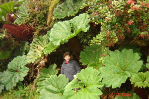


Sheila with Sombrilla de Pobre (Poor Man's Umbrella)

Sheila with Sombrilla de Pobre (Poor Man's Umbrella)

 • Parque Nacional Volcán Irazú:  Es el volcán más alto del país, activo, 3424m de altura. Los turistas suben en auto hasta el cráter, pero conozco un sendero a mitad del camino. Normalmente combino esta caminata con una visita a los jardines Lankester.
Irazú parking lot - estacionamiento en el Irazú

Irazú parking lot - estacionamiento en el Irazu

• Parque Nacional Volcán Turrialba: En este momento muy activo y algunos días la entrada está restringida. 3400m. Subimos por un camino para 4X4. El sendero nos lleva a la base del cráter, la cual es bastante seca.

• Parque Nacional Tapantí: Con bellos paisajes y plantas. Bosque lluvioso de elevación media. 

• Pico Blanco: Caminata con vistas del Valle Central.

• Bosque nuboso y cataratas en mi vecindad: Caminata combinada de caminitos rurales y senderos primitivos.

Volcán POAS Volcano

Sometimes you see it, sometimes you don’t. However, I strongly recommend being there by opening time at 8:00 a.m.

From the hiking point of view, this is not an important site. However, it’s so much fun to see, and the lagoon is beautiful. 

Lo ves, o no lo ves. Por eso recomiendo estar allí a la hora de abrir el parque, a las 8:00 a.m.

Desde el punto de vista del hiking, éste no es un sitio importante. Pero…¡Me encanta verlo! Y la laguna es preciosa.


Cataratas Los Chorros waterfalls

Cataratas Los Chorros waterfalls

vista Los Chorros

vista Los Chorros

Poás trail - sendero a laguna

Poás trail - sendero a laguna

LA LEONA – Corcovado

LA LEONA is the southern entrance to Corcovado National Park—a 45 minute beach walk from Carate, and the most visited of the entrances since it’s accessible by 4X4 road, collective taxi, or small plane. Many of the lodges in the area have their own trails, and offer guided day hikes into the park.

LA LEONA es la entrada sur al Parque Nacional Corcovado, una caminata por playa a 45 minutos de Carate. Es la entrada más visitada, pues también es accesible por doble tracción, taxi colectivo o avioneta. Muchos albergues en la zona tienen sus propios senderos y ofrecen caminatas guiadas dentro del parque.


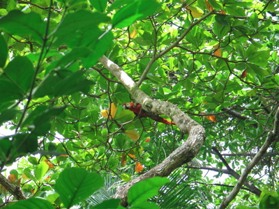
Lapa roja - red macaw

Lapa roja - red macaw


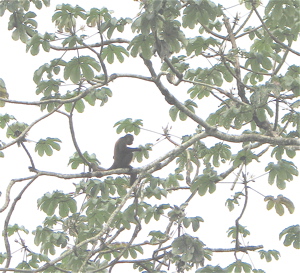
Monkey - mono

Monkey - mono

From the La Leona entrance there’s a 14 Km trail to Sirena. The trail is a combination of soft sand beach, and forest. Finding the trail entrance from beach to forest can be a problem at times (I hope the park service has improved its marking system since my last visit).

Desde la entrada La Leona, el sendero a Sirena es de 14 Km. y es una combinación de playa de arena suelta, y bosque. A veces cuesta encontrar el sendero desde playa hasta bosque (espero que los guardaparques hayan mejorado el sistema de demarcación desde mi última visita).


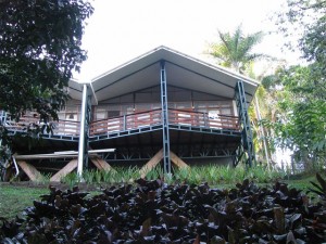
Sirena Biological Station - Estación Biológica Sirena

Sirena Biological Station - Estación Biológica Sirena

Bunk beds at Sirena - Camarotes en Sirena

Bunk beds at Sirena - Camarotes en Sirena


You want to leave a lot of time for this hike. It’s not a gentle beach stroll, and there are many river crossings. If it’s raining, the mud and high water will slow you down.

Para esta caminata se necesita bastante tiempo, pues no es una caminata delicada por la playa y, además, hay que cruzar varios ríos. Si llueve, el lodo y los charcos atrasan al caminante.


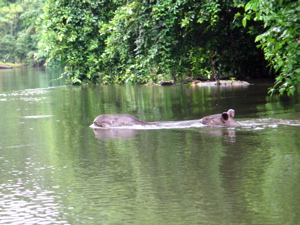
Tapirs - Dantas

Tapirs - Dantas

Rich & Mike

Rich & Mike


At certain river crossings and rocky stretches of beach, you also have to time your hike based on the tides. This timing is difficult for a number of reasons: Your reservation probably won’t coincide with the optimum tide. The hiking time is 7 to 10 hours for most people, making it hard not to have a problem in at least one place, or have to walk softer sand at the very least. For safety, leave enough time to wait out a tide if necessary.

En ciertos cruces de río y trechos rocosos de la playa, uno también puede darse una caminadita si la marea lo permite. Sin embargo, calcular el tiempo para cruzar ríos es dicífil, por las siguientes razones: La reservación que uno hace a veces no coincide con el punto óptimo de la marea. La mayoría de la gente tarda de 7 y 10 horas en hacer esta caminata, e invariablemente tiene problema en por lo menos un lado, o por lo menos debe caminar sobre arena más suelta (lo cual es más lento y difícil). Por seguridad, es mejor dejar suficiente tiempo a que cambie la marea si fuese necesario.


Osa Pics – Fotos en Osa:

Osa 1

Osa 2

Osa 3

Osa sunset

Osa


SAN PEDRILLO – Corcovado National Park

SAN PEDRILLO is the northwest entrance to Corcovado National Park, on the Pacific coast. It can be reached by foot from Bahía Drake bay, or directly by boat. From Drake Bay (boat, plane or 4X4) the hike takes 3 to 5 hours.

SAN PEDRILLO es la entrada noroeste del Parque Nacional Corcovado, en la costa Pacífica de Costa Rica. Se puede llegar a pie desde Bahía Drake, o directamente por lancha. De Drake (en lancha, avión o doble tracción), la caminata es de 3 a 5 horas.


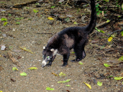
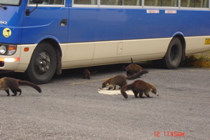
Pizotes are everywhere - Pizotes andan por todo!

Pizotes are everywhere - Pizotes andan por todo!


There are a number of lodges and tent camps along this trail. The trail is a combination of beach and forest with some up and down over headlands. The forest becomes big and impressive when you cross into the park before arriving at San Pedrillo.

Hay varios albergues, pensiones y campamentos en el camino. El sendero es una combinación de playa y bosque, con subidas y bajadas. El bosque se hace amplio e impresionante al cruzar al parque antes de llegar a San Pedrillo.


At the San Pedrillo station there is camping but no food service. The trail to Sirena from here is very long—28 Km., much of it on the beach with little or no shade. The first 7 Km. is up over forest highlands with a steep descent to Llorona Beach. There is a waterfall and sea arch a short distance up the beach to the north. 

En la Estación San Pedrillo hay camping, pero no hay servicio de comida. El sendero a Sirena desde acá es bastante largo —28 Km.— la mayor parte por la playa, con poca o ninguna sombra. Los primeros 7 Km. son por bosque con bajada empinada a Playa Llorona. Hay una catarata y arco a corta distancia de la playa, al norte. 


Mike & Ornit

Mike & Ornit


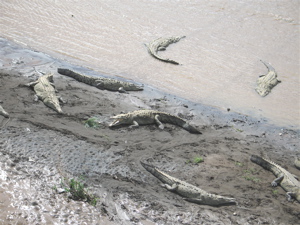
Here also is the first major river crossing. Plan to cross in the 3 hour window before and after low tide, and watch for crocodiles.

Allí hay que cruzar el primer río caudaloso, lo cual recomiendo hacer dentro de las 3 horas antes o después de la marea baja, y echándole ojo a los cocodrilos.


Croco-diles = coco-drilos

Croco-diles = coco-drilos


The next river crossing is the Río Corcovado, 8 Km. south along Playa Llorona. It’s a fast hard-sand hike, and you must cross both rivers in your low tide window mentioned before.

Luego hay que cruzar el Río Corcovado a 8 Km. al sur de Playa Llorona. La caminata es rápida por arena dura, pero debes cruzar ambos ríos en la ventana de oportunidad que mencioné anteriormente.


The hike from here to the Río Sirena river gradually gets more difficult as it turns into a loose sand hike. The Sirena river is deep and has crocodiles. From here, it’s a 2 Km. beach+air strip, or trail hike to the San Pedrillo station.

La caminata desde este punto hasta el Río Sirena gradualmente se hace más difícil, pues la arena es suave. El Río Sirena es profundo y lleno de cocodrilos. De aquí son 2 Km. por playa abierta, o por sendero, hasta la Estación San Pedrillo.


It’s very hard to hit all three rivers at low tide, and balance that against daylight. For that reason, I recommend doing this hike south to north (Sirena to San Pedrillo) unlike how Mike and I did it.

Lo difícil de esta caminata es tener que cruzar los 3 ríos en marea baja, cuidándose de hacerlo en la luz del día. Por esta razón, recomiendo hacerla de sur a norte (de Sirena a San Pedrillo) en vez de la manera en que Mike y yo la hicimos. 


Desde Sirena, uno puede pedirle a los guardaparques o voluntarios, que le crucen el Río Sirena en marea alta, o de noche. Si la marea es favorable, lo mejor es salir entre las 2:00 y las 4:00 a.m.. Así, uno cubre la caminata en arena suave durante la noche, cuando hace menos calor.

From Sirena, you may be able to get one of the park rangers or volunteers to row you across the Sirena river at high tide and at night. If the tides were favorable, a 2:00 to 4:00 a.m. departure would be best. That way you would cover the loose sand portion of the hike in the night or cool off early morning.


It’s a long day, but there is time to rest and wait out a tide. For those hiking light (without camping gear), it’s also enough time to reach a lodge or tent camp at Playa San Pedrillo or Playa San Josecito. From there you can catch a boat to Sierpe, or walk to Drake Bay.

Es un día largo, pero hay tiempo para descansar o esperar la marea. Para quienes viajan sin mucho equipaje, también hay tiempo de llegar a algún albergue en Playa San Pedrillo o San Josecito. De ahí se puede tomar lancha a Sierpe, o caminar hasta Bahía Drake. 


Hola!

Hola!

Ornit is very proud! - Ornit se siente orgullosa!

Ornit is very proud! - Ornit se siente orgullosa!


Hiking Corcovado – LOS PATOS

Occupying a big chunk of the Osa Peninsula in the southeastern Pacific side, Corcovado National Park is one of the best destinations for hiking, wildlife, big trees, and biodiversity. In my opinion, it is the jewel in the crown of the national park system.

El Parque Nacional Corcovado ocupa gran parte de la Península de Osa en la costa Pacífica y es uno de los mejores destinos para caminatas, donde se ven animales y plantas, grandes árboles y se disfruta de la biodiversidad de formas. En mi opinión, es la corona del sistema de parques nacionales.

Trail in Los Patos sector - Sendero en sector Los Patos

Trail in Los Patos sector - Sendero en sector Los Patos

Corcovado has three long-distance trails open to the public, all three ending at Sirena Biológica Station, which also has a system of local trails surrounding it. All three entrances have day hike possibilities both inside and outside the park boundary. To do any of the distance hikes requires advanced reservations, good physical condition, and a lot of preparation. All three trail heads are tough to get to.

Corcovado ofrece tres senderos de larga distancia abiertos al público, los cuales terminan en la Estación Biológica Sirena, también rodeada de su propio sistema de senderos locales. Las tres entradas ofrecen posibilidades de caminatas tanto dentro, como fuera del parque. Para hacer las caminatas de larga distancia hay que hacer reservaciones con antelación, estar en muy buena condición física, y hacer muchos preparativos. Los comienzos de los tres senderos son difíciles de alcanzar.


Great butress/ gamboa grande

Great butress/ gamboa grande


La entrada al sendero LOS PATOS es la única hacia adentro —12 kilómetros al oeste del pueblo de La Palma. El camino (4X4 solamente) cruza el Río Rincón 26 veces y solamente debe intentar hacerse durante la marea baja. El camino en sí ofrece poder hacer caminata y ver pájaros si a uno no le importa andar con los pies mojados.


From the road you see entrances to Danta Corcovado Lodge (info@dantacorcovado.net), the Guaymí indigenous reserve, and ends at Albergue Cerro de Oro (www.turismorural.com). All have lodging and their own trails. The parking lot for Los Patos is on the right, 2 Km. before the end of the road.

El camino pasa frente al albergue Danta Corcovado Lodge (info@dantacorcovado.net), la Reserva Indígena Guaymí y termina en el Albergue Cerro de Oro (www.turismorural.com). Todos estos ofrecen hospedaje y sus propios senderos. El estacionamiento de Los Patos está hacia la derecha, a dos Km. antes que termine el camino.


Danta Corcovado Lodge

Danta Corcovado Lodge


From the parking lot it’s a 2 1/2Km. trail to the park entrance. Los Patos has a campground, but no food service.

Del estacionamiento, hay un sendero de 2 1/2 Km. hasta la entrada del parque. Los Patos tiene zona de acampar, pero no ofrece comida.

 From here, it’s another 17 Km. to Sirena, with about half the hike in hilly terrain and the other half in the lowlands. If wet, expect it muddy and slippery. Dry season is a better time to do this hike, which is entirely an inland hike through the wild center of the park. There are big trees, wildlife, and shade. Start very early if you want to arrive at Sirena before dinner.

De aquí son 17 Km. hasta Sirena, con media caminata sobre terreno colinero y la otra mitad por tierras bajas. Si ha llovido, estará resbaloso y con lodo. Es mejor hacer esta caminata durante la estación seca, pues es una caminata enteramente por el centro del parque. Hay grandes árboles, vida silvestre y sombra. Hay que empezar muy temprano si se quiere llegar a Sirena antes de la cena.

  Waterfall near Los Patos

Waterfall near Los Patos
Rich, Ornit, & Mike

Rich con amigos Ornit & Mike

Driftwood/Madera a la deriva

Driftwood/Madera a la deriva